Map - Cochabamba

Cochabamba
Cochabamba (Quchapampa; Quchapampa) is a city and municipality in central Bolivia in a valley in the Andes mountain range. It is the capital of the Cochabamba Department and the fourth largest city in Bolivia, with a population of 630,587 according to the 2012 Bolivian census. Its name is from a compound of the Quechua words qucha "lake" and pampa, "open plain." Residents of the city and the surrounding areas are commonly referred to as cochalas or, more formally, cochabambinos.

It is known as the "City of Eternal Spring" or "The Garden City" because of its spring-like temperatures all year round. It is also known as "La Llajta," which means "town" in Quechua. It is the largest urban center between the higher capital of La Paz and Santa Cruz de la Sierra in the tropical plains of the east. It sits south-west of the Tunari mountains, and north of the foothills of the Valle Alto. In antiquity, the area featured numerous lakes, which gave the city its name. Many of these lakes have since disappeared to urban development, but Coña Coña and Alalay lakes are extant examples. It has been a populated settlement since the Pre-Inca period, and is today an important cultural, educational, political, and commercial centre.

 
Map - Cochabamba
Map
Google Earth - Map - Cochabamba
Google Earth
Openstreetmap - Map - Cochabamba
Openstreetmap
txu-oclc-49864639-co...
6529x7488
www.lib.utexas.edu
Bolivia_Cochabamba_M...
1181x1181
upload.wikimedia.org
Bolivia_Cochabamba_C...
1181x1181
upload.wikimedia.org
MAPS+COCHABAMBA+DEPO...
1460x820
3.bp.blogspot.com
map-stations1.png
1004x1014
diggingintheclay.fil...
cochabamba-map2.jpg
800x1063
www.justmaps.org
cochabamba-map2.jpg
800x1063
es.justmaps.org
cochabamba-map2.jpg
800x1063
it.justmaps.org
untitled-image-1.jpg
797x1012
willatravels.files.w...
dept-cochabamba-high...
800x912
www.bolivia-excepcio...
Location_map_Bolivia...
860x847
upload.wikimedia.org
Bolivia-Cochabamba_....
860x847
upload.wikimedia.org
768px-Bolivia_Cochab...
768x768
upload.wikimedia.org
cochabamba-map3.gif
865x665
www.justmaps.org
cochabamba-map3.gif
865x665
es.justmaps.org
cochabamba-map3.gif
865x665
it.justmaps.org
map-of-Cochabamba.gi...
865x657
www.boliviahostels.c...
city-and-suburb-map-...
920x507
images.bibliocad.com
609px-Location_map_B...
609x600
upload.wikimedia.org
cb_map.jpg
500x710
www.boliviaweb.com
Country - Bolivia
Flag of Bolivia
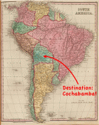
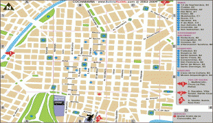
Bolivia, officially the Plurinational State of Bolivia, is a landlocked country located in western-central South America. It is bordered by Brazil to the north and east, Paraguay to the southeast, Argentina to the south, Chile to the southwest and Peru to the west. The seat of government and executive capital is La Paz, while the constitutional capital is Sucre. The largest city and principal industrial center is Santa Cruz de la Sierra, located on the Llanos Orientales (tropical lowlands), a mostly flat region in the east of the country.

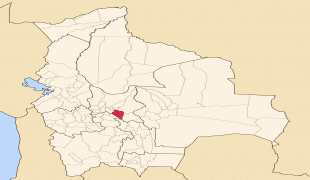
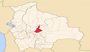
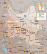
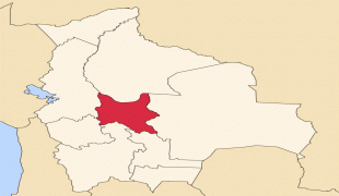
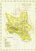
The sovereign state of Bolivia is a constitutionally unitary state, divided into nine departments. Its geography varies from the peaks of the Andes in the West, to the Eastern Lowlands, situated within the Amazon basin. One-third of the country is within the Andean mountain range. With 1098581 km2 of area, Bolivia is the fifth largest country in South America, after Brazil, Argentina, Peru, and Colombia (and alongside Paraguay, one of the only two landlocked countries in the Americas), the 27th largest in the world, the largest landlocked country in the Southern Hemisphere, and the world's seventh largest landlocked country, after Kazakhstan, Mongolia, Chad, Niger, Mali, and Ethiopia.
Currency / Language  
ISO Currency Symbol Significant figures
BOB Boliviano Bs 2
Neighbourhood - Country  
  •  Argentina 
  •  Brazil 
  •  Chile 
  •  Paraguay 
  •  Peru